
离岸价格
Get Latest Price|
1 Set Minimum Order
国:
China
モデル番号:
-
离岸价格:
ロケーション:
-
最低注文量の価格:
-
最低注文量:
1 Set
パッケージの詳細:
-
納期:
-
供給能力:
-
支払いタイプ:
T/T
製品グループ :
-
連絡先担当者 BP
Hefei, Anhui
info(at)smartmaxgeosystems.com
|
HY***0
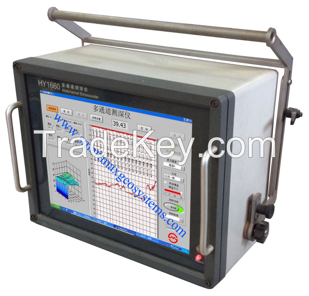
Multi-channel Echosounder Sweep System
|
|
| Overview | |
|
HY***0
Multi-channel Echosounder Sweep System is a hydrographic
echosounder specifically designed for use in
harbors,canals,rivers and other shallow bodies of water.
Especially for use in those application including large
area shallow water surveying, detecting and locating debris
or other hazards to navigation in harbors, rivers or
canals, monitoring the charted safe depth of navigable
waterways, monitoring dredging or underwater construction
operations and so on. This compact multi-channel echosounder, based on Windows XP software, employs not only very reliable embedded main board and redundant RS**2/**2/USB ports, but also those advanced technology involving with channel control, image display and bottom detection. A *5inch large scale LCD display can simultaneously monitor both ***2 channels of depth and bottom profile. All data is shown in *-D and in real time using a color-coded waterfall display which graphically represents areas of common depth using different colors. While sweeping depth data can be simultaneously exported through a RS**2/**2 port to third part survey software running on the same computer. |
|
| Features | |
|
Specially suited
for use in shallow water below *0 meter
Channel combination available from 2 to *2 simultaneously, based on Windows XP and *5 inch LCD display Equipped with redundant RS**2/RS**2/USB ports to output/ raw data Water depth from Multi-channels can be simultaneously stored in the computer's hard driver permanently Event marker operated from menu or by manual and can be searched automatically Raw data and a time-related *-D echogram from any channels can be displayed, replayed on screen Any motion sensors can be interfaced to have a dynamic compensation. |
|
|
|
|
| Specifications | |
| Channels |
***2 available on
request
|
| Range | *0,*0,*0,*0,*0 meters adjustable |
|
Power
consumption
|
approx.*0W
|
| Working mode | time sharing, 8 pings,*6 pings per second vary with the range |
| Pulse width | 0.*5,0.1,0.2, and 0.4ms adjustable |
| Frequency | **8kHz (Beam width ≤8〇 ) |
| Accuracy |
±(0.*1m+ 0.1% D),
D stands for the depth surveyed
|
|
Resolution
|
1cm
|
|
Output
power
|
*0W
|
|
TVG
Curve
|
available
|
| Interface |
3 RS**2
ports(COM1,COM3,COM4); 1 RS**2 COM2 port |
| Other ports | 1 printer port, 1 ethernet network, 2 USB ports |
| Screen display | *5 inches LCD |
| Hard drive | *0G |
| Power supply | AC **0V***0V |
| Working conditions |
Ambient
temperature:0℃**0℃; Relative humidity:≯ *5% |
|
Storage conditions |
Ambient
temperature:**0℃**5℃; |
|
Composition |
|
| Main unit | |
| Dimensions | **0mm***0mm***0mm |
| Weight | *5KG |
| Juction Box | |
| Dimensions | **0mm***0mm***0mm |
| Weight | 5KG |
| Length of cable | *0m and weight 1Kg |
| Transducer | |
| Dimensions | *0mm**0mm |
| Weight | 1.5KG |
|
Length of cable |
*0m (available up to **0m on request) |
| 国: | China |
| モデル番号: | - |
| 离岸价格: | Get Latest Price |
| ロケーション: | - |
| 最低注文量の価格: | - |
| 最低注文量: | 1 Set |
| パッケージの詳細: | - |
| 納期: | - |
| 供給能力: | - |
| 支払いタイプ: | T/T |
| 製品グループ : | - |